This area was originally part of long-established farmlands and formed part of the Duke of Bedford’s estate until the early 1900’s. On the old tithe maps, the larger, lower field (east, adjacent to Horn Lane) was mainly orchard and grazing land and known as Downhorn or Downhorne. The name can also be written as Down Horn (two words) — the origin is unknown. Downhorn Farmhouse, at the top of the field, dates from around 1600 and is thought to have been built on the site of a religious house. The upper field (west, adjacent to Dean Hill) was known as Cole’s or Caul’s Park. The fields are separated by an old walled Devon hedge, which contains a variety of long-established trees and some planted in 2002-2006, although the wall is sadly damaged or removed in several places. The combined area of the two fields is about 0.81 hectares (~2 acres).
The lower field contains a steep curved bank, which appears to be an ancient construction. It has received only limited archaeological investigation. According to Langdon (1995), a small dig in 1978 found that it consisted of hard-packed clay, shale and limestone. It is not clear whether this was constructed as a defensive barrier or as a structure for the stockading of grazing animals, Langdon suggests these are both possible explanations for the origin of the name Plymstock. However, Watts (2010) suggests that the name Plymstock (Plemstocha in the Domesday Book) derives from “outlying field [of Plympton] with a plum tree”, or “an outlying farm belonging to Plympton”. There has also been speculation that a tunnel runs from the farmhouse under the field or to the church, but this has never been properly investigated.
Follow this link to the “Know your Place” website, where you can move between maps of the area in the 1880s and the present day.
Much of the building development around the fields took place in the early 1930s, and many of the orchard trees were lost. In the 1940s-50s, some of the land was turned over to market garden crops. Further changes occurred following the development of the Broadway shopping centre in 1962 and the later expansion of the car park in the late 1970s.
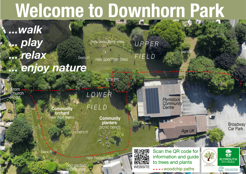
The two fields were designated as public open space in 1967, when several specimen trees were planted. These have now matured, although there have been some recent losses due to disease and storm damage. The community orchard (originally 30 apple trees, but sadly now down to 11 due to damage) was planted in the upper field in 1997 by the children of Downham School. The school occupied the site in Horn Lane adjacent to the field from 1963-2012 when it was sold for development of the Sackville Close estate. Unfortunately, direct access to the field from Horn Lane was lost, when PCC allowed this footpath to be acquired by the estate developer, and access is now through a gate from Sackville Close.
The area is home to over 20 species of birds, and bats feed under the trees on summer evenings. We are hoping to undertake full biodiversity surveys in the coming months.